The Gateway Pundit reported news from the CDC in August that only 6% of all deaths in the US classified as Coronavirus deaths actually died from the China Coronavirus exclusively.
That means the number of those poor people who died from the coronavirus exclusively is much, much lower than the headlines.
Many local and state governments are shutting down their local
businesses and institutions due to over-inflated statistics regarding
the number of Americans who died from this China coronavirus. Will this ever make the mainstream news?
But is the CDC also using other statistical tricks this year?
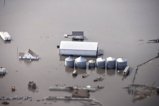
In less than an hour, the nearly 2,000 acres of corn and soybeans that Corey Hillebo and his family farm near Slater were flattened.
"Nothing in the path of the storm was unscathed," said Hillebo, who lives near where Monday's derecho, packing hurricane-force winds, left Heartland Cooperative's massive grain storage bins twisted and crumpled.
"You drive around, there's nothing that's not leaning or flat," he said.
Across Iowa, the storm hit about 10 million acres of crops, Gov. Kim Reynolds said Tuesday during a news conference. The Iowa Department of Agriculture said the storm affected roughly a third of the state, which grows about 32 million acres of corn, soybeans and other crops.
Reynolds said farmers have told her the damage "has just been devastating ... they have never seen anything like this."
The storm, with straight-line winds nearing 100 mph, pummeled homes, farms and businesses across dozens of counties in central Iowa. In addition to crops, it destroyed grain bins, machine sheds, barns and livestock buildings.
GENEVA - The World Food Program reports unprecedented flooding in South Sudan has plunged some 700,000 people into a hunger and livelihoods crisis, made worse by ongoing violence and economic shocks due to COVID-19.
Nearly half of South Sudan is under water. The World Food Program reports entire villages, homes, and farmlands in 36 counties are submerged. It says the situation is particularly dire in Jonglei State, where one-third of the country’s 700,000 flood victims live.
WFP Country Director in South Sudan, Matthew Hollingworth says 85,000 people have been displaced by the flooding, which has disrupted trade routes, damaged crops, killed livestock and submerged houses.
“This flooding crisis is coming on top of a very grim hunger situation in Jonglei where already this year 1.4 million people were suffering from acute and severe hunger in addition to over 300,000 children under five who are acutely malnourished,” Hollingworth said.
People in the San Francisco Bay Area and across California awoke on Wednesday morning to an eerie scene of darkened, orange-hued skies and ash raining down as historic wildfires rage across the state.
The apocalyptic skies are due to light being filtered through smoke from California’s worst fire season on record, according to a regional air pollution control organization the Bay Area Air District.
“These smoke particles scatter blue light and only allow yellow-orange-red light to reach the surface, causing skies to look orange,” the Bay Area Air District said on Twitter.
Residents of the Bay Area reported oversleeping because the sky was so dark. Local police forces recommended drivers keep headlights on all day and bridges and street lights remained alight as the sun failed to appear this morning.
Surreal images of blood orange skyline flooded social media on Wednesday.
Record low temperatures across regional South Australia brought rare snow to the Flinders Ranges on Friday, August 7, turning the red outback desert into a winter wonderland.
Records for the lowest daily maximum temperature were broken on Thursday at several locations including Hawker, Whyalla, Yongala, and Port Augusta. The Bureau of Meteorology expected more temperature records to be broken on August 7.
A cold blast of wintry air brought the conditions to Australia in early
August, according to the weather bureau. Snow was reported in parts of
Tasmania, Victoria and New South Wales.
Videos posted by the Skytrek Willow Springs Station show snow blanketing
the red desert around the outback station. Staff from the station told
Storyful they had seen snow on the top of the hills around them before but never so much down in the valley.
The German economy contracted at its steepest rate on record in the
second quarter as consumer spending, company investment and exports all
collapsed during the peak of the COVID-19 pandemic, wiping out nearly 10
years of growth.
The Federal Statistics Office said gross domestic output in Europe’s
largest economy shrank by 10.1% quarter-on-quarter from April to June
after a revised 2.0% contraction in the first three months of the year.
The
plunge was the steepest since the office began collecting quarterly
growth data in 1970 and was worse than the 9% contraction predicted by
economists in a Reuters poll. Adjusted for inflation, seasonal and
calendar effects, it erased almost a decade of growth, the statistics
office said.
Global food production is being hit from seemingly every side.
Thanks to absolutely crazy weather patterns, giant locust armies in
Africa and the Middle East, and an unprecedented outbreak of African
Swine Fever in China, a lot less food is being produced around the world
than originally anticipated. Even during the best of years we really
struggle to feed everyone on the planet, and so a lot of people are
wondering what is going to happen as global food supplies become tighter
and tighter. The mainstream media in the United States is so obsessed
with politics right now that they haven’t been paying much attention to
this emerging crisis, but the truth is that this growing nightmare is
only going to intensify in the months ahead.
In Australia, conditions have been extremely hot and extremely dry,
and that helped to fuel the horrific wildfires that we recently
witnessed.
And everyone knew that agricultural production in Australia was going
to be disappointing this year, but it turns out that it is actually
going to be the worst ever recorded…
Australia’s hottest and driest year on record has slashed crop production, with summer output expected to fall to the lowest levels on record, according to official projections released Tuesday.
The country’s agriculture department said it expects production of crops like sorghum, cotton and rice to fall 66 percent — the lowest levels since records began in 1980-81.
The continent of Australia is considered to be one of the
breadbaskets of the world. According to the U.S. Department of
Agriculture, in 2018/19 Australia exported over 9 million tons of wheat to the rest of the world.
But thanks to relentless crop failures, Australia has started to import wheat, and that is likely to continue for the foreseeable future.
So instead of helping to feed the rest of the world, Australia is now relying on the rest of us to help feed them.
And what is happening this year didn’t just barely break the old
records. In fact, one senior economist says that this will be the worst
summer crop production the country has ever seen “by a large margin”…
“It is the lowest summer crop production in this period by a large margin,” Peter Collins, a senior economist with the department’s statistical body ABARES told AFP.
Of course if the rest of the world was doing great we could certainly survive a downturn in Australia.
Unfortunately, that is definitely not the case.
Right now, billions upon billions of locusts are voraciously
devouring farms in eastern Africa and the Middle East. As I detailed the other day,
giant armies of locusts the size of large cities are traveling up to
100 miles per day as they search for food. When they descend on a farm,
all the crops can be consumed literally within 30 seconds.
It is a nightmare of epic proportions, and UN officials are telling us
that this crisis is only going to get worse over the next couple of
months.
The last 12 months have been the wettest in all of U.S. history,
and this has created absolutely horrific conditions for U.S. farmers.
Thanks to endless rain and historic flooding that has stretched on for
months, many farmers have not been able to plant crops at all, and a lot
of the crops that have actually been planted are deeply struggling.
What this means is that U.S. agricultural production is going to be way,
way down this year. The numbers that I am about to share with you are
deeply alarming, and they should serve as a wake up call for all of us.
The food that each one of us eats every day is produced by our farmers,
and right now our farmers are truly facing a nightmare scenario.
You can view the latest USDA crop progress report right here. According to that report, corn and soybean production is way behind expectations.
Last year, 78 percent of all corn acreage had been planted by now. This year, that number is sitting at just 49 percent.
And the percentage of corn that has emerged from the ground is at a
paltry 19 percent compared to 47 percent at this time last year.
We see similar numbers when we look at soybeans.
Last year, 53 percent of all soybean acreage had been planted by now. This year, that number has fallen to 19 percent.
And the percentage of soybeans that have emerged from the ground is
just 5 percent compared to 24 percent at this time last year.
In other words, we are going to have a whole lot less corn and soybeans this year.
Farmers in the middle of the country desperately need conditions to
dry out for an extended period of time, but so far that has not
happened.
In fact, last week the heartland was hit by yet another string of devastating storms. The following comes from CNN…
Ten people are dead and a 4 year-old boy remains missing
after more than a week of severe weather across the central US that put
tens of millions of people at risk.
The deadly spring storm system ravaged several states, unleashing
more than 170 reported tornadoes, fierce winds, drenching rain, flash
flooding and hail.
One of the tornadoes that was spawned absolutely devastated the
capital city of Missouri. It was reportedly a mile wide, and it stayed
on the ground for almost 20 miles…
A clearer picture emerged Friday of the size and scope of
the powerful tornadoes that tore across Missouri on Wednesday night,
leaving a trail of destruction in their paths. The state’s capital,
Jefferson City, was among the hardest-hit places, struck overnight by a
tornado with a peak wind speed of 160 mph that has been given
preliminary rating of EF3.
The monstrous nighttime tornado that struck Jefferson City, a city
with a population of about 42,000, was almost a mile wide and was on the
ground for nearly 20 miles, toppling homes, ripping roofs off homes and
business below.
What we are witnessing is definitely not “normal”, and I have had a
number of readers write to me about this recently. The other day one of
my readers in Montana sent me a photograph of a freak May snowstorm
that had just hit his area, and another one of my readers in Missouri
explained that his boss is freaking out because they haven’t been able
to get soybeans in the ground. All over the country people want
answers, and they are frustrated with the lack of information that they
are getting from the mainstream media.
Unfortunately, the truth is that things are going to get worse.
Global weather patterns are dramatically shifting, and there is nothing
that the authorities will be able to do to stop it from happening.
DENVER — Colorado has been fully taken over by drought. And for the
metro area, things are moving into a historic snowless territory.
The drought has dramatically expanded recently. Thursday’s drought
monitor indicates that more than 98 percent of the state is in a
drought, up from only 10 percent at the start of the year.
For most, a dry weather pattern took over in midsummer when the rains ended.
And little snow has materialized. The mountains have had barely 5 to
10 inches across most of the ranges. Denver has yet to see its first
snow.
In Denver, the last snow was May 1. The number of days without
snowfall is at 193 as of Thursday, the eighth-longest streak since 1948.
In 1992, Denver went 211 days without snow and 2016 might rival that record.
The latest measurable snowfall in Denver was Nov. 21, 1934 and that
record might fall this year unless the persistent warm, dry weather
pattern breaks down soon. Fox
Firefighters battle the Blue Cut wildfire near Cajon Pass, north of San Bernardino, California, on Aug. 16, 2016.
As
more than 100,000 Americans flee destructive wildfires in California
and floods in Louisiana, earth sends yet another reminder that the worst
is yet to come: a new record for planet-wide heat.
Last month
wasn’t just the hottest July on record for the surface of earth. It
continued the longest-ever streak of record-breaking months—15,
according to data released on Wednesday by the National Oceanic and
Atmospheric Administration (NOAA). July followed the hottest June,
May, April, March, February, January, December, November, October, and
September, along with last August, July, June, and May.
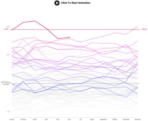
The extremes of recent months are such that we're only midway into 2016, and there’s already a greater than 99 percent likelihood
that this year will go down as the hottest on record, according to
Gavin Schmidt, who directs NASA’s Goddard Institute for Space Studies.
NASA and NOAA maintain independent records of the earth’s temperatures,
and both agree that last month was a scorcher. "July 2016 was absolutely
the hottest month since the instrumental records began," Schmidt wrote
on Twitter. The interactive chart below shows earth’s warming climate, measured by land and sea, dating back to 1880.
In Baton Rouge, La.,
days of heavy rainfall caused water to overrun levees along several
tributaries this week. About 40,000 homes in southeastern Louisiana have
been affected by the floods, and at least 11 people have died. In
California, more than 80,000 people fled out-of-control wildfires after
the state's fifth year of drought turned forests into tinderboxes.
Wildfire season typically doesn't begin until fall.
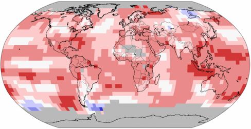
The July
heat was experienced differently across the globe but was felt to some
degree almost everywhere. The dark red swaths on the map below show
areas that set new records.
NOAA
Some
of this is still the result of El Niño, which releases heat from the
Pacific that typically lingers for months after the underlying
conditions subside. Last year's powerful El Niño may soon shift to a
cooling La Niña, according to NOAA’s Climate Prediction Center. The
agency gives a 55 percent to 60 percent chance of a La Niña pattern developing in the fall or winter. That, however, doesn’t change earth’s long-term trajectory.
This
year is on track to be the third consecutive year to set a new global
heat record. So far, 15 of the hottest 16 years ever measured have come
in the 21st century. Results from the world’s chief monitoring agencies
vary slightly, but all agree that the extremes of 2016 are unrivaled—for
now. Bloomberg
Residents
in many parts of Mexico might decide to remain in their homes for this
long weekend as heavy rains, strong winds, some snow and cold
temperatures are forecast for many regions.
In fact, the national
Civil Protection office has declared an “extraordinary emergency” in 446
municipalities in 23 states, brought on by cold front No. 34 and the
eighth winter storm of the season.
The declaration will make
resources available for the emergency supply of food and blankets to an
estimated half a million people from Chihuahua in the north to Chiapas
in the south.
The
cold front´s mass of polar air is covering much of the country,
guaranteeing cold to very cold weather for the weekend. Sleet or wet
snow are forecast for areas 3,500 meters above sea level in the State of
México, Tlaxcala, Puebla, Hidalgo and Veracruz and winds gusting to 70
km/h in the Isthmus of Tehuantepec.
Mountain regions of Chihuahua, Durango, Zacatecas and Nuevo León can expect temperatures to plunge lower than -5 C.
The
weather in both Mexico and California has been having adverse effects
on fresh produce supplies in the U.S. and Canada. The second-largest
food retailer in Canada said last week there would be shortages for
three weeks due in part to weather conditions.
Sobey´s said it is struggling to deal with the worst situation in 30 years.
One
of the coldest places in Mexico this week was La Rosilla, a community
in the Durango municipality of Guaneceví. The temperature dropped two
days ago to -17 C.
In Nuevo León, meanwhile, the roofs of many
homes in the community of Galeana, located in the south of the state,
collapsed under the weight of the heaviest snowfall in 20 years. MexicoNewsDaily
When
compiling the data for mass shootings (where four or more people have
died as per FBI definition of mass murder) under the last five
presidents, clearly there's a startling outlier under the Obama
administration. Largest push for gun control in American history just so
happens to coincide at a time when there are more mass shootings than
ever before in American history. What are the odds?
We're
talking a 700+% increase in mass shootings where four or more people are
killed just since George Jr. was president... More mass shootings than
the four presidents before him combined BY FAR.
Frosty weather sent chills through Northern California and slashed records Monday as temperatures dipped into the icy 20s.
Temperatures
weren’t as cold as they had been in Alturas, Calif., which registered
minus 3 degrees Sunday, and Bogard, east of Lassen National Park, which
had dipped to minus 11 degrees.
But the weather was cold enough to break records in Redding and Red Bluff.
“Redding and Red Bluff have already broken their record
lows for the date, and most other valley sites are currently within a
couple degrees of setting record lows,” the National Weather Service in Sacramento said in a statement.
Redding
clocked in at 27 degrees, which is three degrees colder than the
previous record of 30 degrees set in 2006, according to the weather
service.
Temperatures reached 28 degrees in Red Bluff, one degree below the old record of 29 degrees set in 2006.
An offshore cold front was to blame for the freezing temperatures over the weekend that continued into Monday.
The
cold system was expected to weaken Monday, but it could bring light
showers to portions of Northern California. Dry conditions will return
Tuesday with temperatures slightly warming up.
In Central
California, a storm from the Gulf of Alaska will bring the large
northwest swell through Tuesday. Surf could reach 12 feet with the
potential for higher sets on northwest and west-facing beaches.
Inexperienced
swimmers and surfers were urged to stay out of the water because of
dangerous rip currents and sneaker waves, the weather service warned.
By
Thursday, widespread rain, snow and wind could return to Northern
California. A high pressure system moving into Southern California this
weekend will produce warm and dry conditions. latimes
Temperatures in certain parts of the Pacific Ocean are warmer right now than at any time in the last 25 years at least, according to data
from the US National Oceanic and Atmospheric Administration. The
reason: an El Niño, one that scientists say has a chance at being the
biggest one ever recorded.
It’s a sign that this El Niño could surpass in
strength the previous record-setting events of 1997 and 1982. Both of
those events were Super El Niños. This year’s event looks so much
stronger than the 1997 record that a climatologist compared it to an upstart displacing a grand sumo wrestling champion.
El Niño is a weather phenomenon that arises when
sea surface temperatures in the equatorial Pacific Ocean rise, pushing
northward the heavy rains that usually fall on South American
rainforests.
It typically results in drought in South America
and Australia, mild winters in the northeastern United States, and heavy
rain in the southern US.
Temperatures in a key spot off the coast of Peru
were recorded last week at 5.4º Fahrenheit (3º Celsius) above average.
In 1997, the same spot was 5º above average.
El Niños are tricky to predict, though, and
scientists caution that just because the data shows a major event could
happen, that doesn’t mean it will.
Certain rainfall patterns that were well
established by this point in 1997 haven’t developed yet, the National
Weather Service’s Climate Prediction Center deputy director Mike Halpert
told the Los Angeles Times. But, he cautioned, they still could.
The National Weather Service has forecast an unusually wet winter in California. Agencies throughout the state are clearing flood channels and storm drains in preparation for heavy rains. Officials in southern California are trying to relocate homeless people living in drains and washes before deadly floods endanger their lives.
The system’s effects are already being felt elsewhere in the world. This year’s El Niño has been blamed for devastating droughts in Indonesia,
for example. Continuing drought in affected countries could kill crops
and raise rice prices, leading to poverty and food insecurity for
millions.
“We expect this year to peak in the top three,
with 1997 and 1982, but where it falls is too early to say. But
regardless of where it is ranked, this has been a significant event,”
NOAA meteorologist Tom DiLiberto told the Guardian. “We are seeing impacts across the globe already.”
Thomas M. Kostigen, Special for USA TODAY
6:06 a.m. EST November 7, 2015
There is a theory about snow in Siberia during the month of October: If there is a lot, it can mean a particularly wicked winter in the northeast United States.
Last month, Siberia experienced record snowfall and the worst blizzard in a decade.
Above-average
snow cover in Siberia is believed to affect the now-famous polar vortex
and send bitterly cold temperatures to the Northeast. This happens when
the Arctic Oscillation, a climate pattern, shifts.
When its winds are strong, the Arctic Oscillation keeps
a tight hold on temperatures swirling around the North Pole. When it
becomes weakened, or what meteorologists call “negative,” it allows
arctic air masses to creep into the mid-latitudes.
The National Oceanic and Atmospheric Administration (NOAA)
describes it this way: “Air pressure is higher than average over the
arctic and lower than average over the mid-latitudes. The jet stream
shifts southward of its average latitude.” That steers frigid, polar air
southward into North America.
Above-average Siberian snow cover
points to a negative oscillation pattern. But not always. And it is
especially not certain that will happen this winter. Myriad factors, not
the least of which is the strong El Niño being experienced globally, come into play.
Atmospheric and Environmental Research scientist Judah Cohen, who tracks the Arctic Oscillation and its correlation to U.S winters, wrote on his blog: “It
is challenging to anticipate how the final outcome of competing
forcings from the tropics and the high latitudes will influence
mid-latitude weather.”
He explains that while October snow cover
was above normal in Siberia this year, it did not advance as much as the
previous two Octobers. Moreover, Arctic sea ice
extent remains below normal. Cohen is expecting important pattern
changes this month will provide better clues to the winter ahead.
At
the moment and for the short-term, he is forecasting a mild pattern.
Still, it’s worth checking Arctic Oscillation reports (the Climate Prediction Center provides 14-day forecasts) and taking steps to prepare for the worst. USAToday
Hurricane Patricia headed toward
southwestern Mexico Friday as a monster Category 5 storm, the strongest
ever in the Western Hemisphere that forecasters said could make a
“potentially catastrophic landfall” later in the day.
Residents of
a stretch of Mexico's Pacific Coast dotted with resorts and fishing
villages on Thursday boarded up homes and bought supplies ahead of
Patricia's arrival.
With maximum sustained winds near 200 mph, Patricia is the
strongest storm ever recorded in the eastern Pacific or in the Atlantic,
said Dave Roberts, a hurricane specialist at the U.S. National
Hurricane Center.
Patricia's power was comparable to that of
Typhoon Haiyan, which left more than 7,300 dead or missing in the
Philippines two years ago, according to the U.N.’s World Meteorological
Organization.
In Mexico, officials declared a state of emergency in
dozens of municipalities in Colima, Nayarit and Jalisco states that
contain the bustling port of Manzanillo and the posh resort of Puerto
Vallarta. The governor of Colima ordered schools closed on Friday, when
the storm was forecast to make what the Hurricane Center called a
“potentially catastrophic landfall.”
According
to the 2010 census, there were more than 7.3 million inhabitants in
Jalisco state and more than 255,000 in Puerto Vallarta municipality.
There were more than 650,000 in Colima state, and more than 161,000 in
Manzanillo.
Rain pounded Manzanillo late Thursday while people
took last-minute measures ahead of Patricia, which quickly grew from a
tropical storm into a Category 5 hurricane, leaving authorities
scrambling to make people safe.
At a Wal-Mart in Manzanillo, shoppers filled carts with non-perishables as a steady rain fell outside.
Veronica
Cabrera, shopping with her young son, said Manzanillo tends to flood
with many small streams overflowing their banks. She said she had taped
her windows at home to prevent them from shattering.
Alejandra
Rodriguez, shopping with her brother and mother, was buying 10 liters of
milk, a large jug of water and items like tuna and canned ham that do
not require refrigeration or cooking. The family already blocked the
bottoms of the doors at their home to keep water from entering.
Manzanillo's “main street really floods and cuts access to a lot of other streets. It ends up like an island,” Rodriguez said.
In
Puerto Vallarta, restaurants and stores taped or boarded-up windows,
and residents raced to stores for last-minute purchases ahead of the
storm.
The Hurricane Center in Miami warned that preparations
should be rushed to completion, saying the storm could cause coastal
flooding, destructive waves and flash floods.
“This is an extremely dangerous, potentially catastrophic hurricane,” center meteorologist Dennis Feltgen said.
Feltgen
said Patricia also poses problems for Texas. Forecast models indicate
that after the storm breaks up over land, remnants of its tropical
moisture will likely combine with and contribute to heavy rainfall that
is already soaking Texas independently of the hurricane, he said.
“It's only going to make a bad situation worse,” he said.
In Colima, authorities handed out sandbags to help residents protect their homes from flooding.
By
early Friday, Patricia's maximum sustained winds had increased to 200
mph — a Category 5 storm, the highest designation on the Saffir-Simpson
scale used to quantify a hurricane's wind strength.
Patricia was
centered about 145 miles southwest of the Pacific resort of Manzanillo
early Friday and was moving northwest at 12 mph on a projected track to
come ashore between Manzanillo and Puerto Vallarta sometime Friday
afternoon or evening.
Some fluctuations in intensity were forecast
before then, but the Hurricane Center said it was expected to be an
“extremely dangerous” Category 5 storm when it made landfall.
A
hurricane warning was in effect for the Mexican coast from San Blas to
Punta San Telmo, a stretch that includes Manzanillo and Puerto Vallarta.
A broader area was under hurricane watch, tropical storm warning or
tropical storm watch.
The Hurricane Center said Patricia was
expected to bring rainfall of 6 to 12 inches, with isolated amounts of
up to 20 inches in some locations. Tropical storm conditions were
expected to reach land late Thursday or early Friday, complicating any
remaining preparation work at that point.
“We are calm,” said
Gabriel Lopez, a worker at Las Hadas Hotel in Manzanillo. “We don't know
what direction (the storm) will take, but apparently it's headed this
way. … If there is an emergency we will take care of the people. There
are rooms that are not exposed to wind or glass.”
People
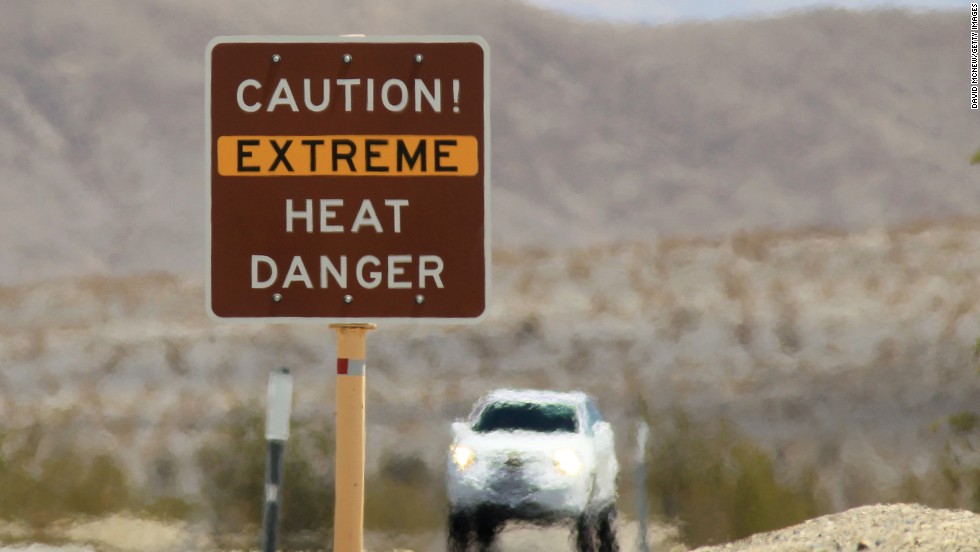
who go to Death Valley in California expect extreme heat. Climate
researchers think we're experiencing the highest temperatures the Earth
has seen since the Bronze Age.
(CNN)Are you still wearing shorts and T-shirts? If you say yes, there's a good reason.
Planet
Earth has definitely experienced its hottest summer since detailed
records have been kept, and according to scientists, it might have been
the hottest in more than 4,000 years.
Seven
out of the nine months this year have made their way to the record
books. Now that it's fall, September saw its highest temperature on
record, for land and ocean surfaces.
What do scientists point to for this phenomenon?
"The
unprecedented heat continues to be driven by the strong El Niño in the
Pacific," said CNN senior meteorologist Dave Hennen. "We're now five
months in a row of record highs, and that will likely continue with El
Niño forecast to last well into the spring."
Climate research suggests these are the hottest temperatures the Earth has seen since the Bronze Age.
The
report also said record heat was reported across northeastern Africa
stretching into the Middle East, part of southeastern Asia, most of the
northern half of South America, and parts of central and eastern North
America.
However, not all regions
experienced above-normal temperatures. Southern South America, far
western Canada, Alaska and a swath across central Asia were cooler or
much cooler than average.
"With
a 98% chance that the strong El Niño conditions will last, it is
virtually certain that this year will end up globally being the warmest
on record," according to Hennen.
The
last strong El Niño was back in 1997. That year it wreaked
weather-related havoc across the globe, from mudslides in California to
fires in Australia.
According to NOAA,
the average temperature over global land and ocean surfaces for
September 2015 was at 1.62 degrees Fahrenheit warmer than the 20th
century average.
Experts predict El
Niño will peak in late fall/early winter, and forecasts now suggest it
will remain constant through winter and gradually weaken as spring
settles in.
By DANIEL MANZO, DAVID CHIU & DAN PECK. Oct 3, 2015, 7:29 PM ET
PlayChuck Burton/AP Photo
WATCH Historic Rainfall, Flooding to Hit the East Coast
A major storm that has already brought over a foot of rain to parts of
South Carolina is expected to bring more heavy rain over the next 24
hours. Some spots in South Carolina could receive over a half foot of
additional rainfall this weekend.
The torrential rains, stretching from the Carolinas to New Jersey, have left five governors declaring a state of emergency.
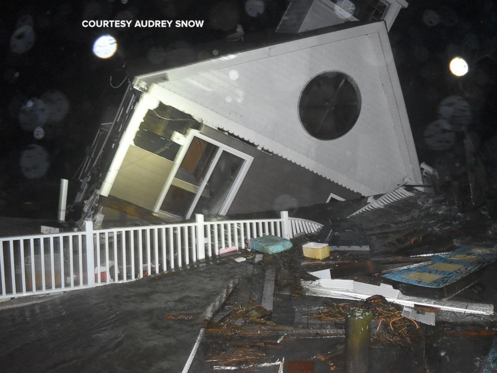
This home on the New Jersey coast was swept away and destroyed Friday.
Courtesy Audrey Snow
This home in North Wildwood, New Jersey, was destroyed from flooding Oct. 2, 2015.
Tom Mihalek/Reuters
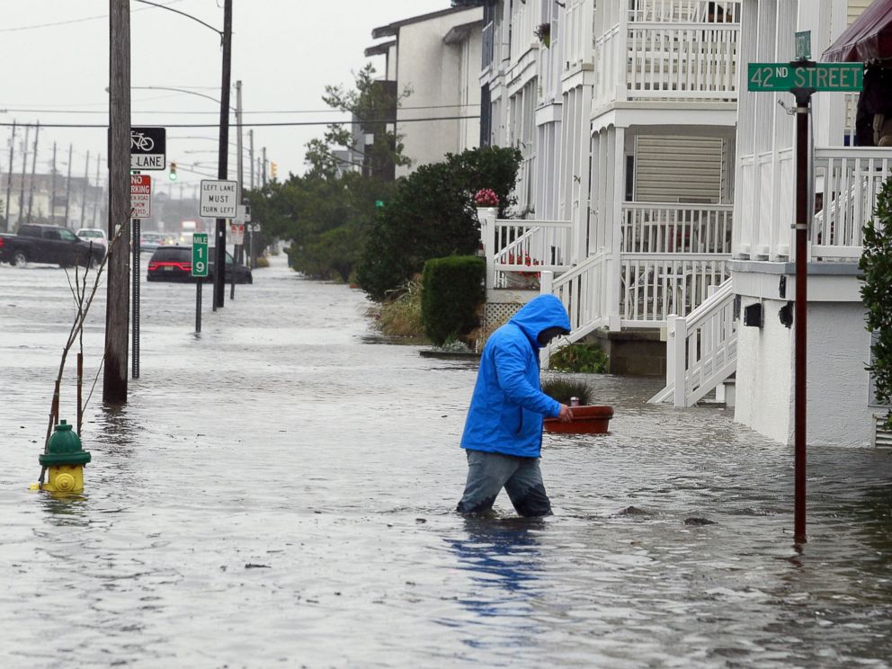
A
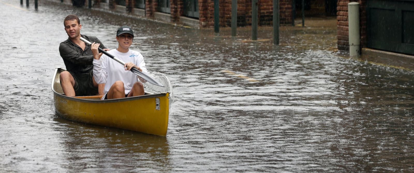
man walks through knee-deep water along a flooded West Avenue as a
nor-easter comes on shore in Ocean City, N.J., Oct. 2, 2015.more +
The risk of flooding will continue through Monday morning, with the
possibility of roads being washed away and rivers and creeks rising
rapidly.
Overnight, rescue teams scrambled to rescue more than 13 people from
flooded homes in Myrtle Beach, South Carolina. At least 50 homes were
evacuated in the coastal town of Calabash, North Carolina.
South Carolina Gov. Nikki Haley even emphasized the seriousness of the storm during a press conference
Friday. "We're going see rainfall at historic levels. This will be a
historic rainfall event that we've never seen before in South Carolina."
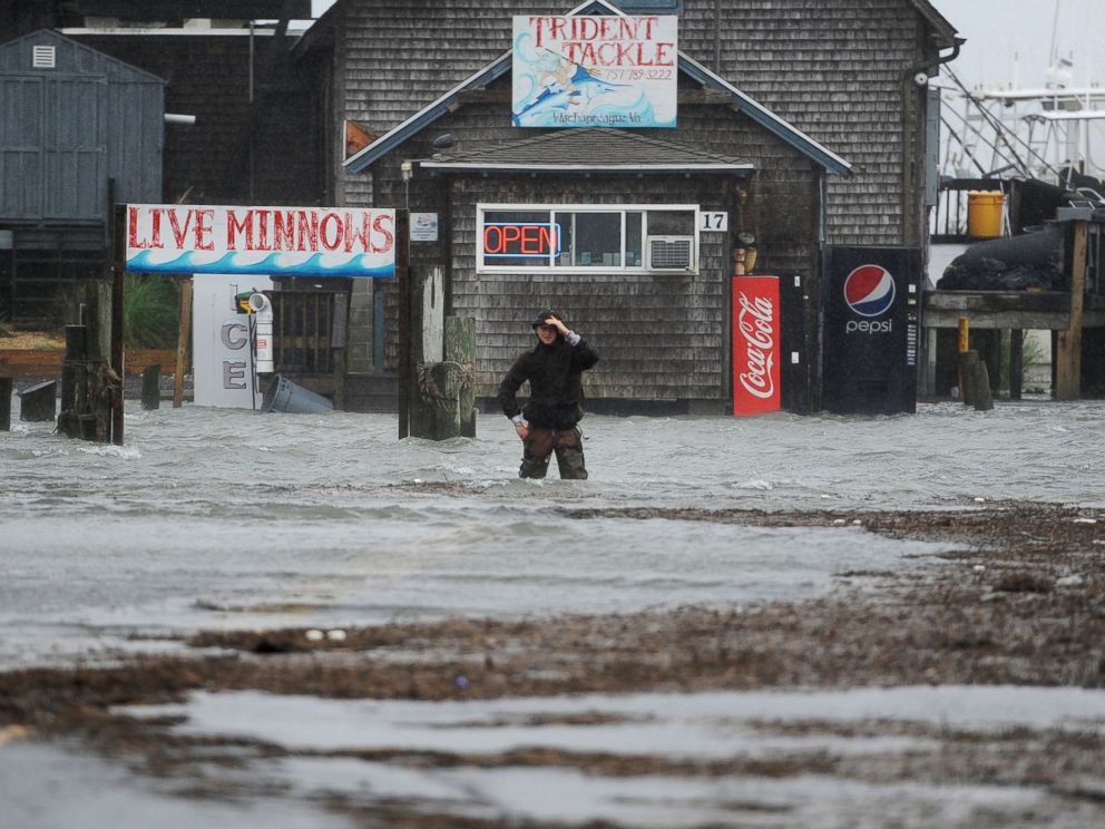
Jay Diem/The Daily Times via AP
Quinn Hurt looks across Atlantic Avenue as he attempts to cross the flooded street in Wachapreague, Va., Oct. 2, 2015.
As of this evening, numerous flash flood watches and warnings are in
effect for portions of North and South Carolina, including a Flash flood
warning in the Charleston area. Local law enforcement in Charleston,
South Carolina, has shut down several roads on the peninsula, stopping
traffic from entering the city.
The ground is already saturated in the Southeast due to ongoing rains this past week.
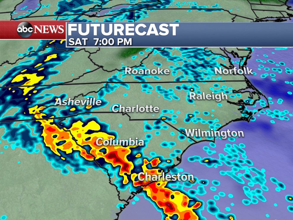
ABC News
On
Saturday evening, rounds of heavy rain will continue across much of
South Carolina with unsettled weather expected across much of the
mid-Atlantic region.more +
The storm has been linked to the death of a passenger whose vehicle was
hit by a fallen tree near Fayetteville, North Carolina, as well as a
drowning in Spartanburg, South Carolina, The Associated Press reported.
Outside of South Carolina, coastal flooding and heavy rains will persist along much of the East Coast this weekend.
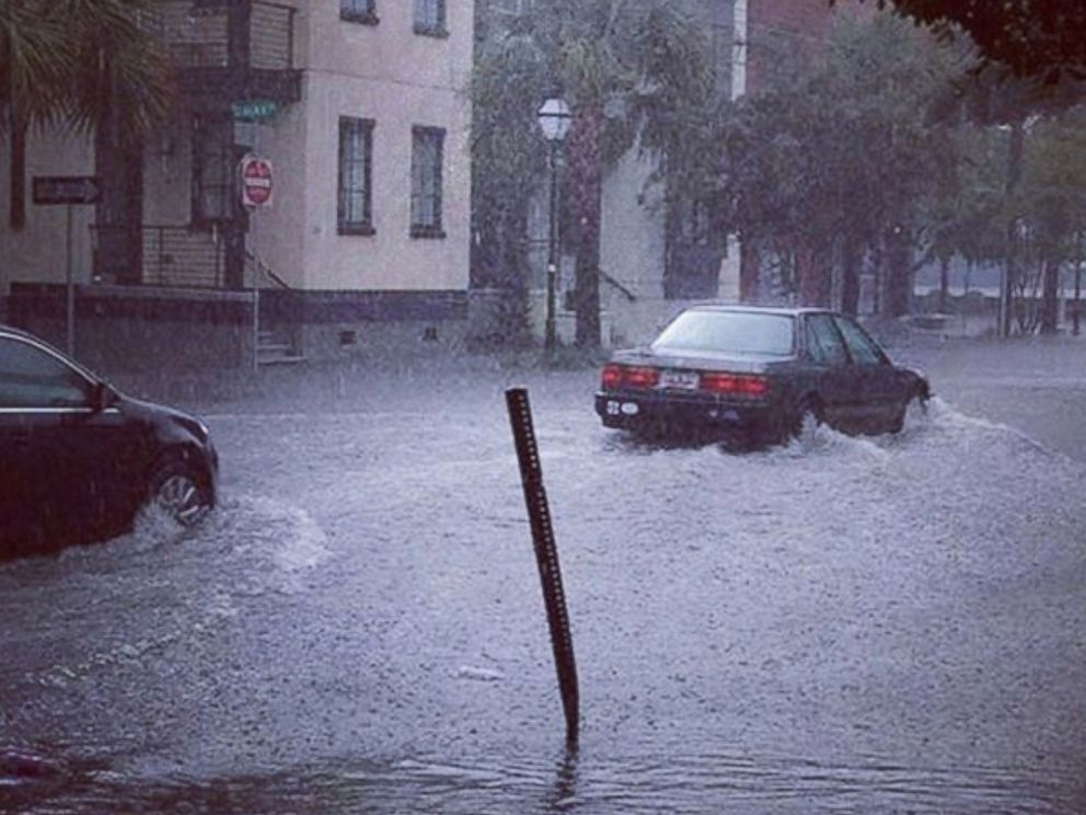
Instagram/@somerr_cronley
@somerr_cronley posted this photo to Instagram on Oct. 2, 2015.
Throughout Saturday evening, rounds of heavy rain will continue to move
through parts of the Carolinas, with southern South Carolina of
particular concern.
Meanwhile, Hurricane Joaquin is beginning to slowly weaken once again.
As of Saturday evening, Joaquin was a category 4 storm with sustained
winds of 150 mph.
Even with this strengthening, Joaquin was still expected to weaken significantly before reaching Bermuda, if it does.
Even as Joaquin is kept away from the East Coast, it will still bring tropical moisture to the rainstorm spanning Georgia to New England.